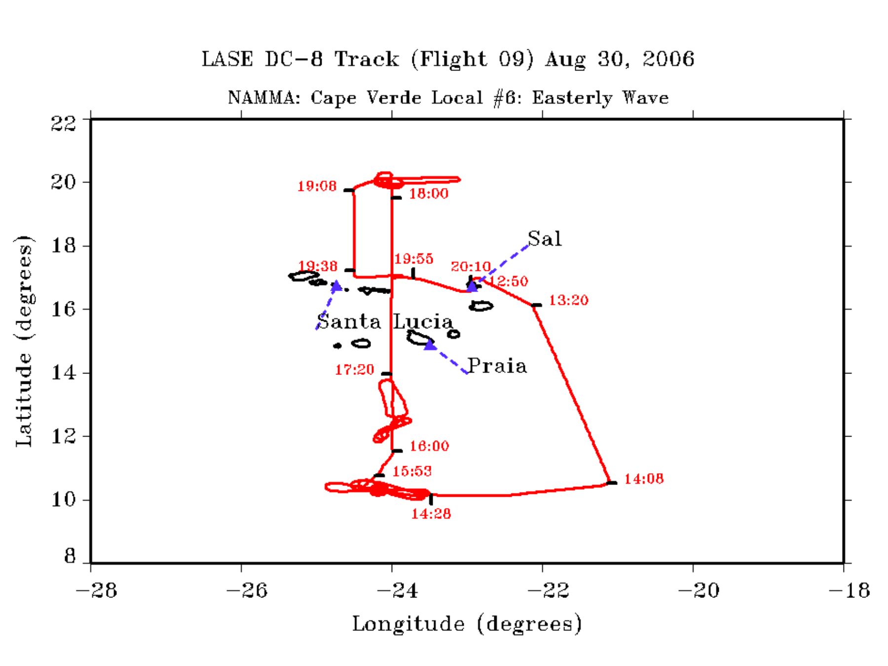
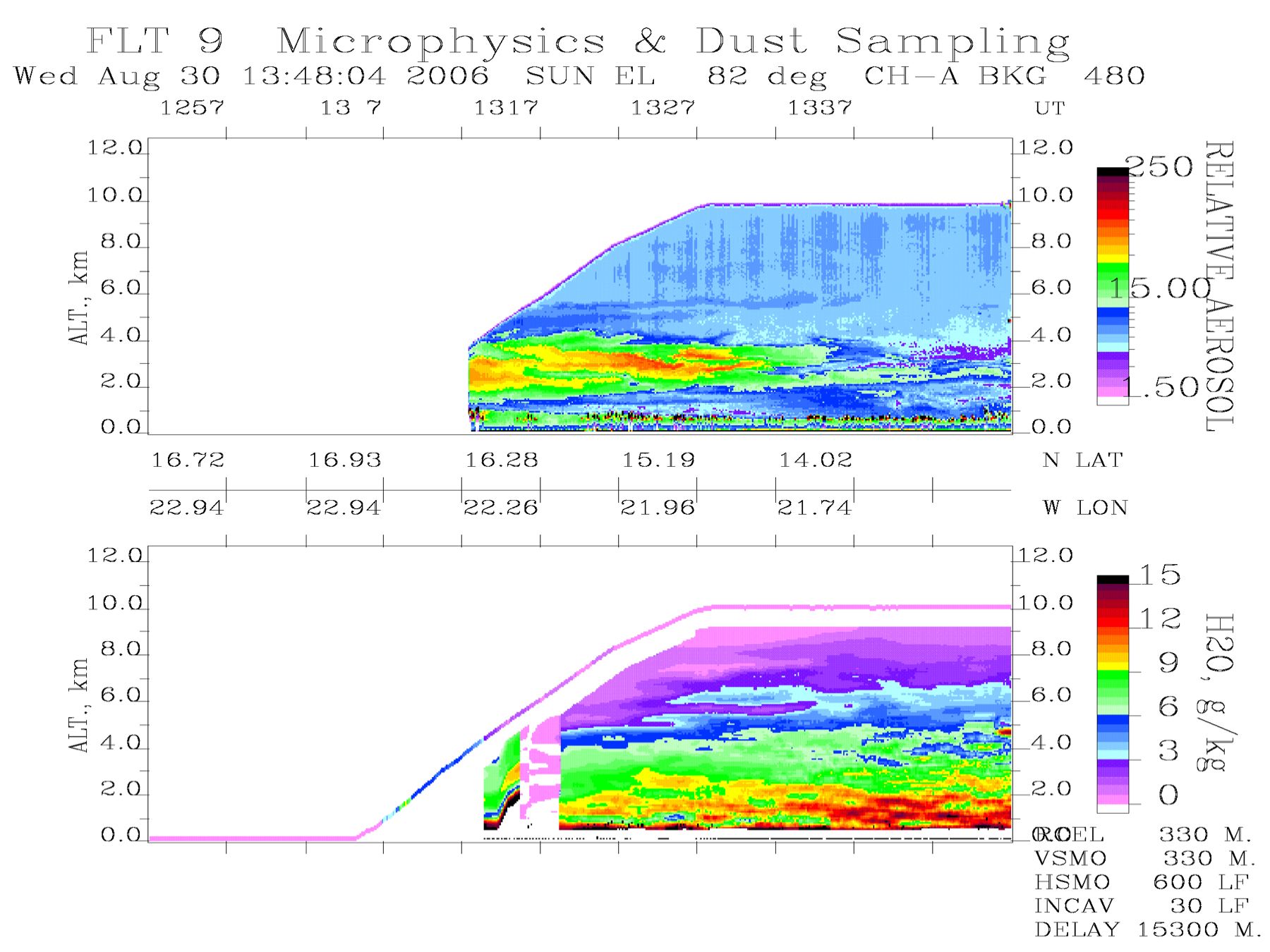
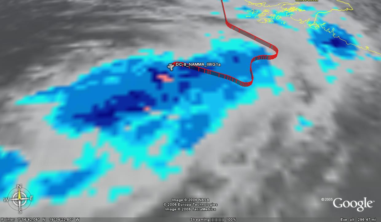
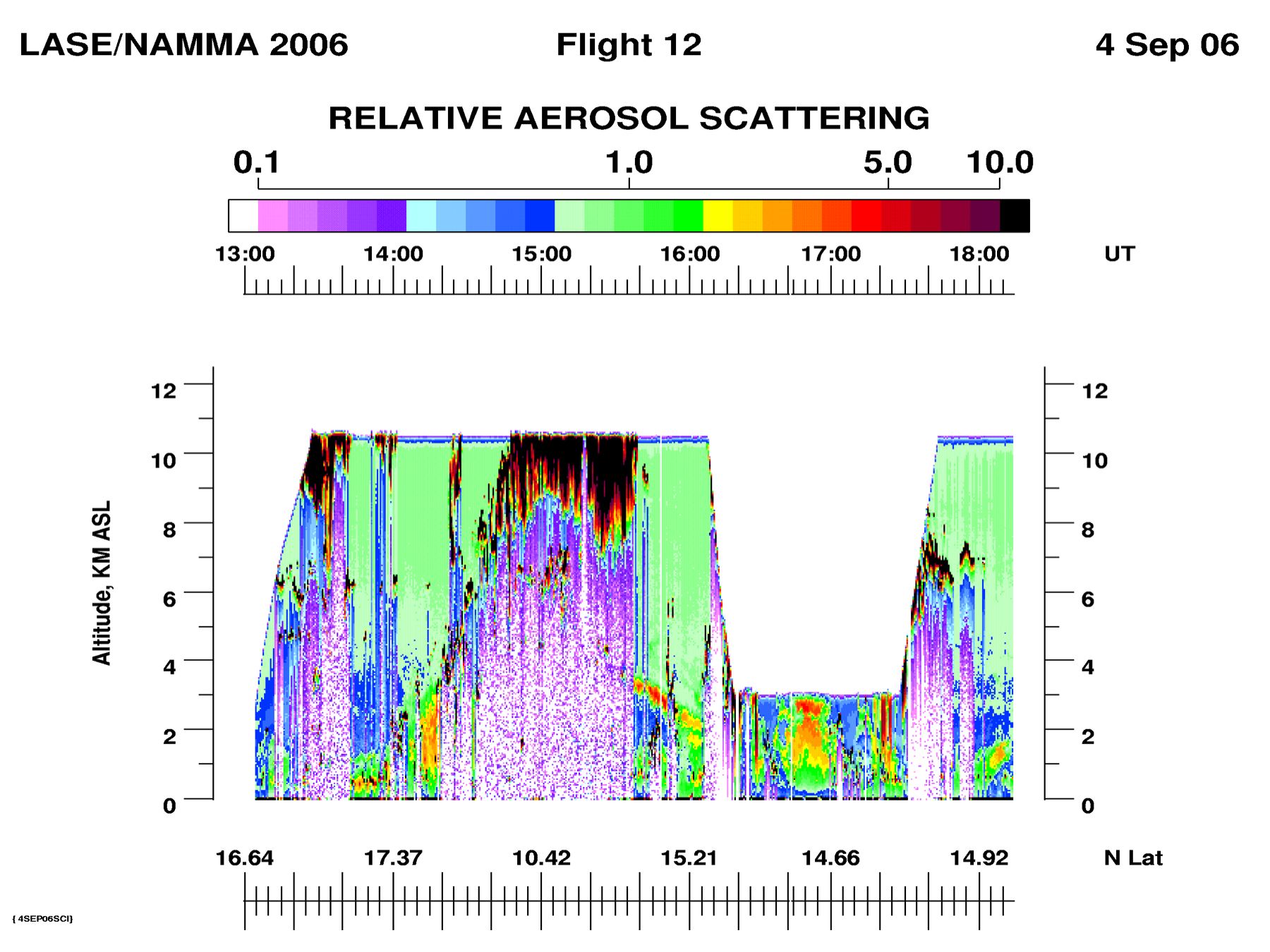
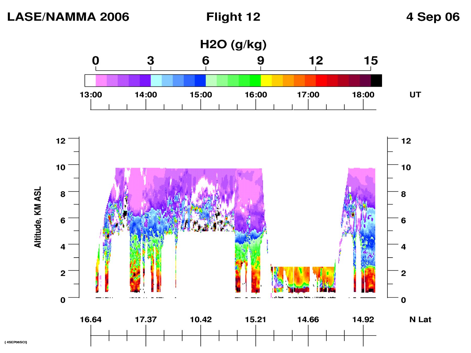
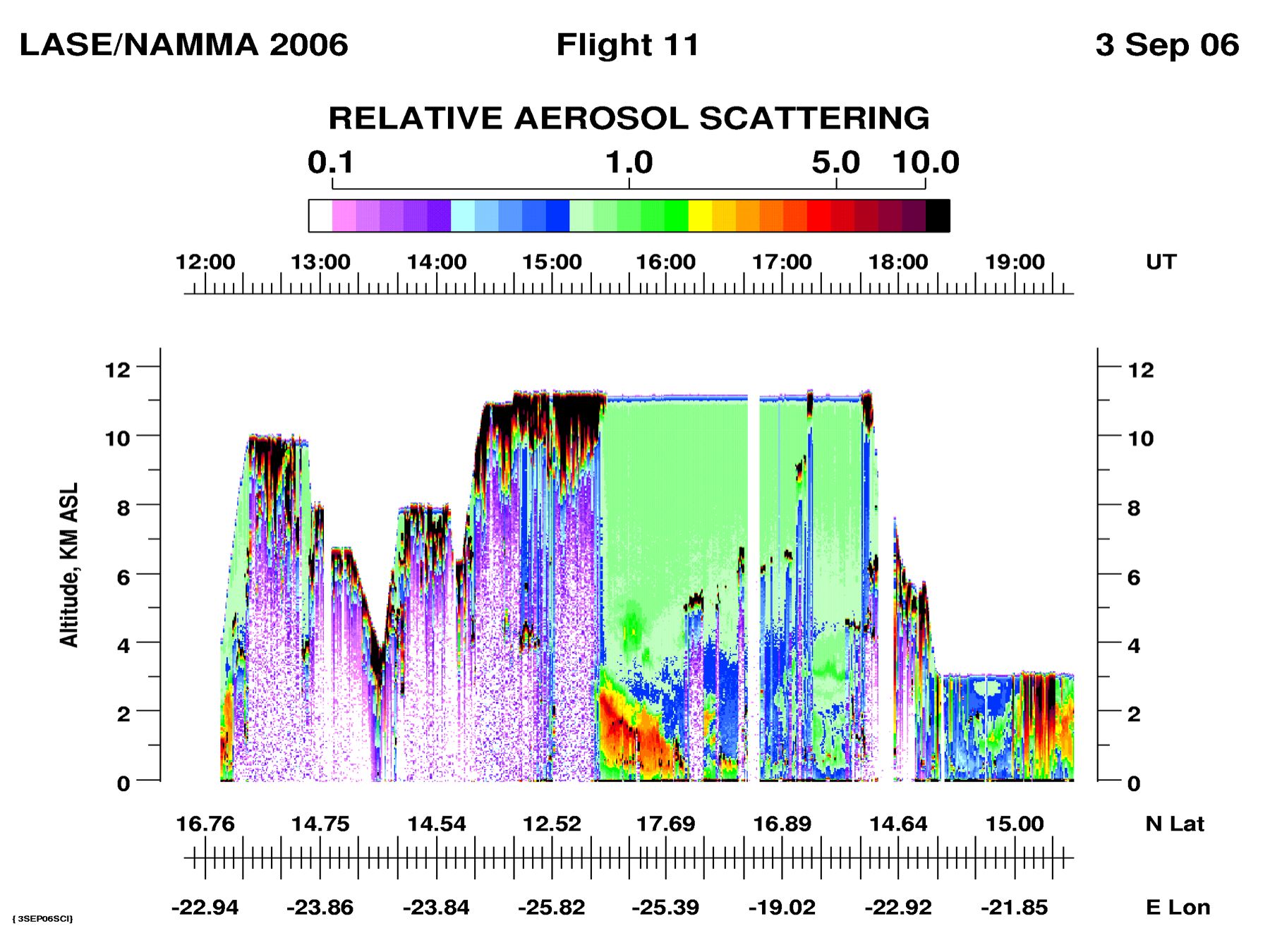
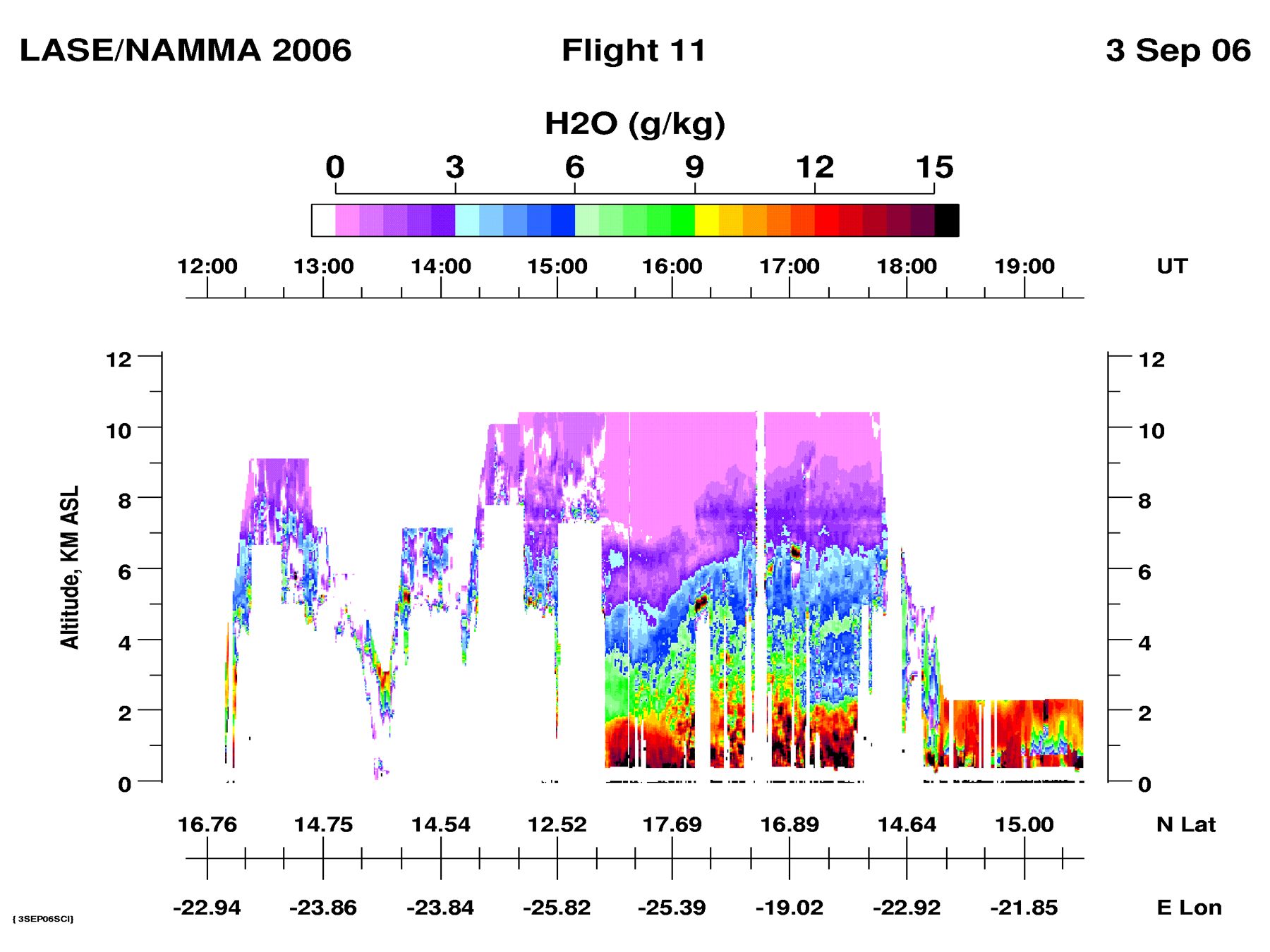
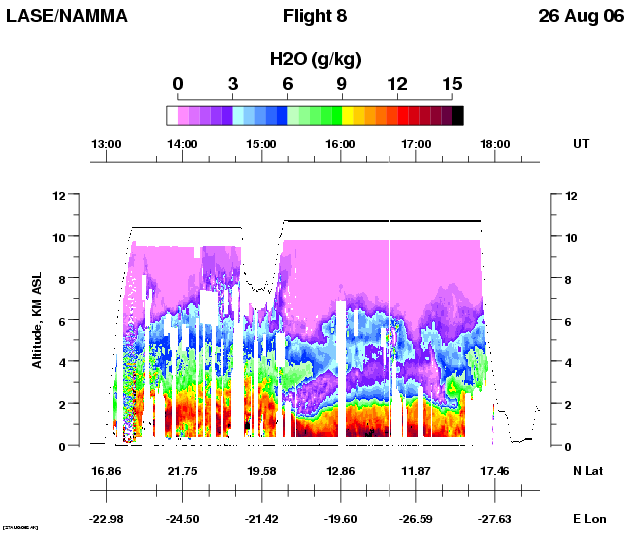
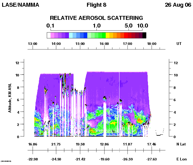
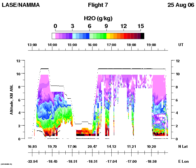
LASE had a great flight observing dust, water vapor, and cloud distributions on this combined cloud microphysical and dust sampling flight. On the south-east bound leg towards the cloud microphysics region near the ITCZ, LASE observed reasonable heavy dust loading near Sal in the 1-4 km altitude range, but the dust layer thinned out to a very light dust layer less than 700-m thick centered at 2.5 km. When we saw the first cloud, the dust layer ended. More on this later. At the same time as the dust layer was thinning, the moisture below 4 km was increasing, and interestingly, at the same time the marine boundary layer decreased in depth to ~700 m.
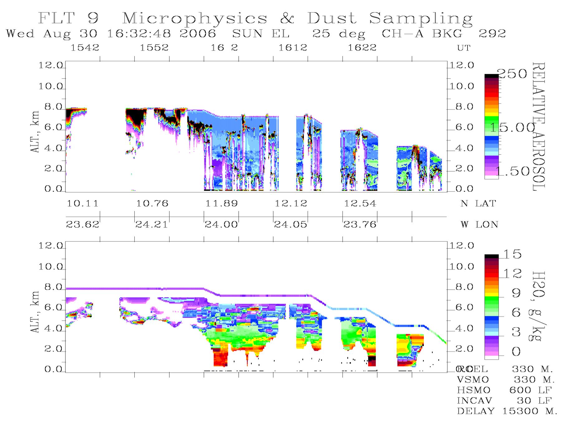
The cloud microphysics experiments were all done in clouds so there was no useful LASE data collected at that time. We went into a “clean cloud” sampling mode around 1600 UT, and what was interesting in that series of passes through a deep convective cloud was the observation by LASE showing the end of the dust layer on the north side of the cloud and clean conditions on the south side of the cloud. This was probably due to a convergence region where air with dust from north met clean air from the south, and convection developed at that location. This condition can be readily seen near 1622 UT.
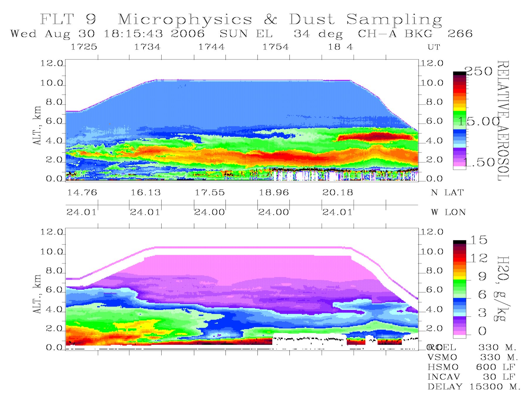
The last 3 hours of the flight was devoted to dust and “dirty cloud” sampling. We flew from about 12.5N to 20N at high altitude to get a cross section of the dust and moisture along 24W. The dust layer became heavier as we went north, and by 20N the layer extended from the top of the clouds at 1.5 km to 6 km. A second dust layer was observed centered at 4.5 km with the main layer centered at 2.5 km. The moisture distribution was also very interesting. The transition from a very deep moist lower troposphere south of 12N to very dry conditions at 20N. There were several inversions of the moisture profile observed at ~1738 UT and at 20N. At 20N the upper dust layer was dry with the moisture and dust negatively correlated across the entire layer. The lower dust layer was drier in the upper part of the layer and more moist near the surface, which was similar to other observed dust layers. We overflew past 20N by 2 minutes and then descended to spiraled down to 500 ft at 20N. A lot of good in situ measurements were made on that spiral. Once down near the surface we did “dirty cloud” sampling before going back up to 7500 ft for the south-bound leg at 24 20′W to sample the dust layer. The leg was offset to try to compensate for the drift in the dust layer. LASE only did zenith measurements on this leg.
Quicklooks:
